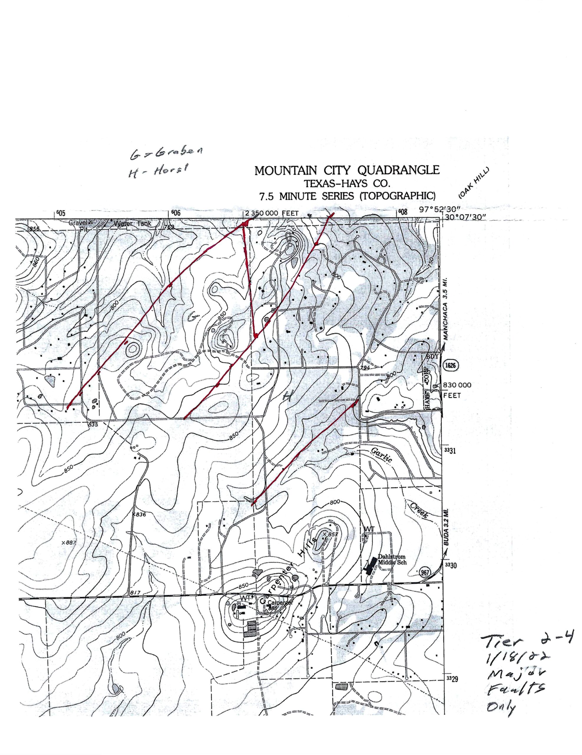
Segment 2-4 is in the northeast corner of the Mountain City Quadrangle. It is also on the transitiion ramp between the Mt Bonnell Fault to San Marcos Springs Fault. The geologic map is shown below.
[Please note that the current draft topographic base map is shown before the draft geologic map. This base map will soon have the geology and will replace the draft geologic map.]
The overall geologic framework is in many ways emblematic of the Balcones Fault Zone (BFZ), with Cretaceous bedrock strata highly disrupted by numerous faults of the tensional system. The faults are aligned primarily in a northeast direction. The oldest bedrock strata crop out in the northwestern part of the Segment, and younger strata are downfaulted and exposed in the southeastern part. The faults are readily discernible in air photos where they disrupt the Georgetown–Del Rio–Buda (marl-clay-limestone) sequence. However, they are not easy to detect in exposures of Edwards Group because of the comparative uniformity of the of Edwards limestone strata. There is therefore often little contrast in air photo appearance across faults, making them difficult to discern. An overview of the geologic features of Segment 2-4 is shown below.
PREVIOUS VERSION:
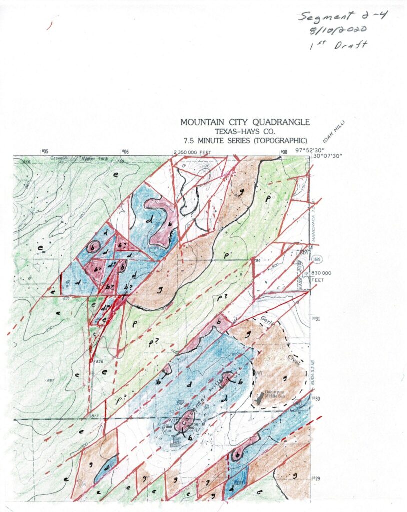

The Elliot Ranch Graben, located in the north-central part of the Segment, is an exception to the general pattern. It is downfaulted with respect to strata of the Edwards Group in it’s northwest, south and southeast borders. The surface exposures in the graben are mostly of the Del Rio Clay and overlying Buda Limestone, which are younger than the surrounding Edwards limestones. The graben is named for the Elliot Ranch development, a gated community built on and around it. The horst on the southeast flank of the graben has exposures of the Person Formation of the Edwards Group, with the overlying Georgetown Formation occurring in its northwest edge. This pattern seems to indicate that the horst is a tilted fault block with a significant dip of its strata to the northwest toward the graben.
A large-displacement faults along the southeast edge of the horst marks the beginning of a series of step faults to the southeast. The two knolls of Carpenter Hills consist of Del Rio Clay with Buda Limestones caps. The southern hill is crossed by RR 967. A similar hill is located about a half a mile to the southeast. It is crossed by Hy Road. The Buda Limestone caps, which have relatively greater resistance to erosion, protect the underlying Del Rio Clay. The hills are left standing above the surrounding area because of faster erosion of the clay substrate.
The area around Carpenter Hills and Garlic Creek is a relatively flat “plain” with Georgetown and Del Rio Clay in the substrate. The contact between the Georgetown and Del Rio is not distinct and is difficult to map on air photos because of mass movement and surface wash of the clay, which obscures the contact.
The southern edge of the Segment has a series of northeast trending faults that separate semi-parallel fault blocks. They are bound on the northeast by a family of north-trending faults. More detail on these blocks and their “sawtooth” pattern is provided in the Segment 3-4 description.
Elliott Ranch Graben Detail
[In preparation. Photo of entry sign. Circular Buda block?]

Carpenter Hills Detail
[In preparation. Air photo. Tree-capped hill. Buda-Del Rio contact. Del Rio exposure.]

[In preparation]

[In preparation]